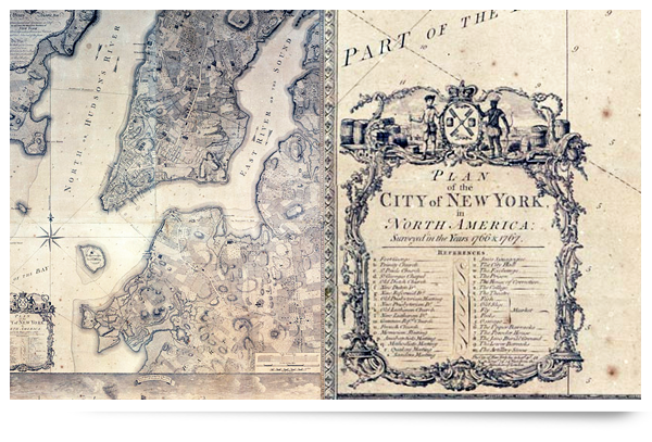
Maps have always been particularly interesting to me, especially really old ones. That's why this story really caught my attention; a 240-year-old map of New York was discovered in storage at the Brooklyn Historical Society.
They went through a painstaking series of restoration techniques in order to remove the destructive shellac and grime that covered the map, not to mention the dozens of breaks. The discovery was that of a Ratzer map, which carries the same weight as a new Da Vinci discovery. It was an early edition of his best-known work: a Bernard Ratzer "Plan of the City of New York in its 1770 state. The surveyor and draftsman maps were considered leaps and bounds over his predecessors, and its plain to see in the intricate details and accuracy. Its particulary interesting to see one of the biggest cities in the world before all of the sprawl; a mixture of the familiar with the old.
There are some great before and after pictures posted, detailing the wonderful restoration of this cartographic treasure. Check it out here.
